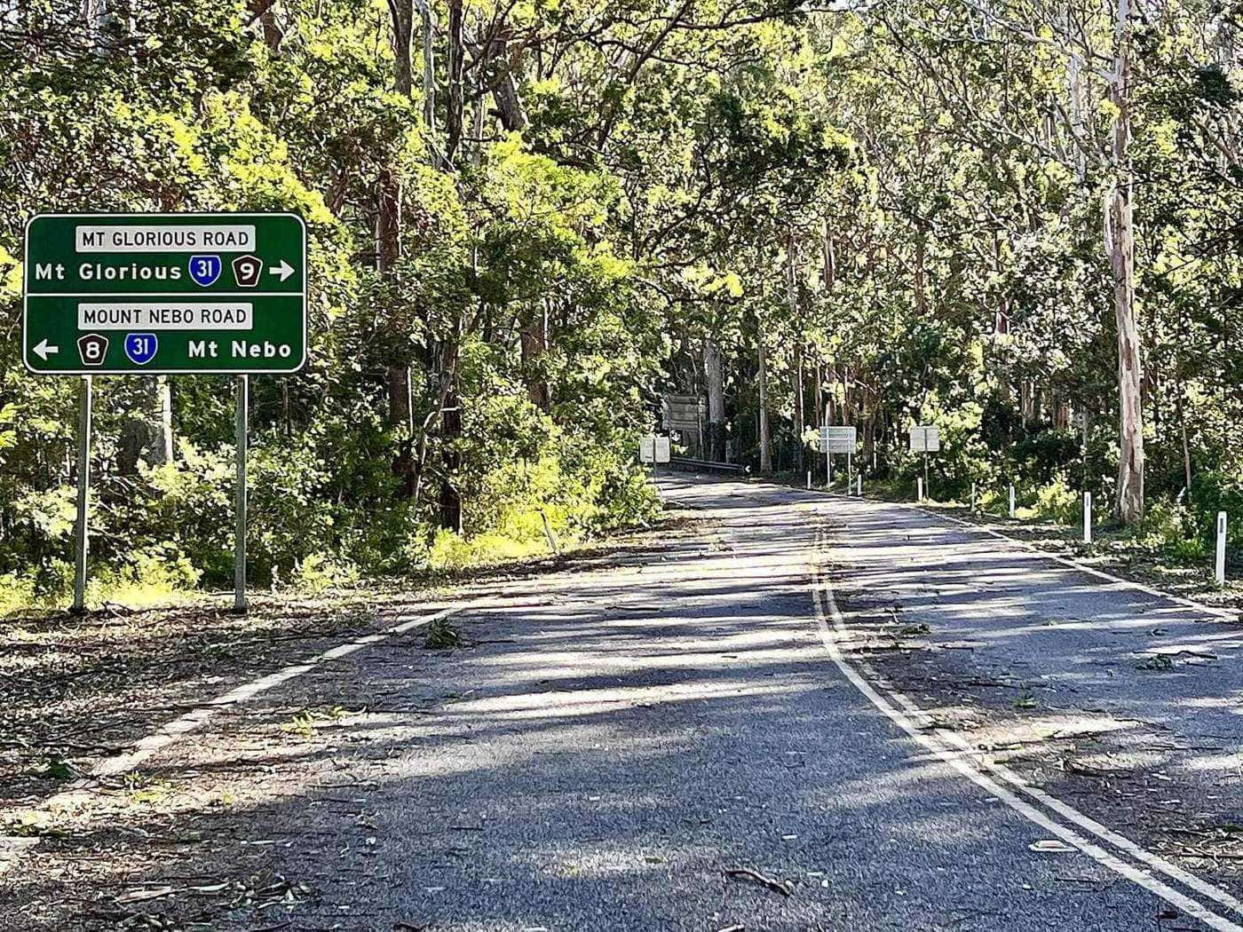
Mount Nebo Road is the classic way to Mount Glorious. Signed as tourist route 8, it leaves the Brisbane suburb of The Gap and climbs steadily through D'Aguilar National Park to the mountain villages of Mount Nebo and Mount Glorious. QPWS describes it as a beautiful scenic drive that winds through varied eucalypt forest types and passes several lookouts along the way. This guide takes you up the road stop by stop, with the facilities and walks at each.
Route 8
Tourist route
Mount Nebo Road
~30 km
Walkabout Creek to Maiala
QPWS figure
617 m
Mount Nebo
Summit height
Before you go
- Fuel and cash. There is no fuel or ATM on the mountain. Fill up before you leave the suburbs.
- Time. Allow at least an hour each way without stops, and a full day if you want to walk and picnic.
- Facilities. Toilets are at Walkabout Creek, Bellbird Grove, Jollys Lookout and Maiala.
- No pets. Domestic animals are not allowed in the national park, including at picnic areas.
- Alerts. Check QPWS park alerts for closures of day-use areas and tracks.
Stop by stop
1. Walkabout Creek Discovery Centre
The drive begins at the southern gateway to the park. Walkabout Creek Discovery Centre, at 60 Mount Nebo Road, The Gap, has a visitor centre, a wildlife centre, wildlife discovery shows, a cafe and a function centre. It is the place to pick up the South D'Aguilar topographic map, learn about the park and see some of its wildlife up close. Ranger-guided activities and talks are run from here.
From the centre, the Araucaria track is a 5 kilometre return Grade 3 walk, allowing about two hours.
2. Bellbird Grove
A short way up the road, Bellbird Grove is a large, open day-use area in a forest grove, with toilets, barbecues, picnic tables and wheelchair access that may require assistance. Two short Grade 3 circuits start here:
- Turrbal circuit: 1.7 kilometre circuit, allow 45 minutes.
- Golden Boulder track: 1.8 kilometre circuit, allow 45 minutes. QPWS notes that remains of gold mine shafts from the area's small-scale gold mining, which began around the 1860s and ended in the 1950s, can be seen along this track.
3. Camp Mountain lookout
QPWS describes Camp Mountain lookout as a steep walk through the forest rewarded with knockout views over Brisbane and beyond. It has picnic tables but no toilets. The lookout was constructed in the 1970s.
4. Jollys Lookout
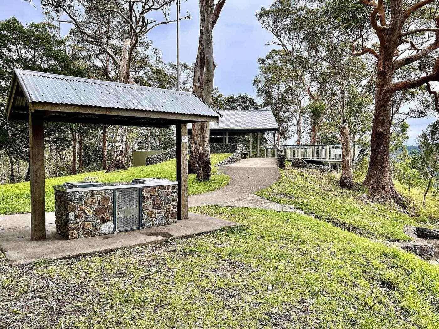
Jollys Lookout is the best-known stop on the road, with sweeping panoramic views east, a relaxed picnic ground with barbecues and toilets, and wheelchair access that may require assistance. It became a national park in 1938.
Two walks start here:
- Egernia circuit: 1.5 kilometre circuit, Grade 3, allow 45 minutes. Egernia is the genus name long used for the land mullet skink.
- Thylogale track: 8 kilometres return, Grade 3, allow 3 hours. Thylogale is the genus of the pademelons.
5. Boombana
Boombana is a trailhead, declared a national park in 1950, with no toilets, barbecues or tables. From here the Pitta circuit is a 1 kilometre Grade 3 loop, allowing about 30 minutes, an easy way to step into the forest.
6. Manorina
Just before Mount Nebo village, Manorina is described by QPWS as a picturesque forest haven of bushwalks, country views and wildlife. It has no toilets or tables. Manorina became a national park in 1949. Walks include:
- Atrax circuit: 750 metres return, Grade 3, allow 20 minutes.
- Morelia track: 6 kilometres return, Grade 4, allow 2 hours.
7. Mount Nebo village
The road passes through Mount Nebo, a small mountain village of 430 people at the 2021 census, rising to 617 metres. Mount Nebo was opened up in 1919, when the Highlands Estate was subdivided into smaller blocks for soldiers returning from the First World War. Please drive slowly through the village.
8. Maiala and Mount Glorious
Another stretch of winding road brings you to Mount Glorious and the Maiala day-use area on the north-west edge of the village, with toilets, barbecues, picnic tables and five walking tracks, including the Rainforest circuit and the Greenes Falls track. See our Maiala walks guide.
9. Westridge Outlook and Wivenhoe Outlook
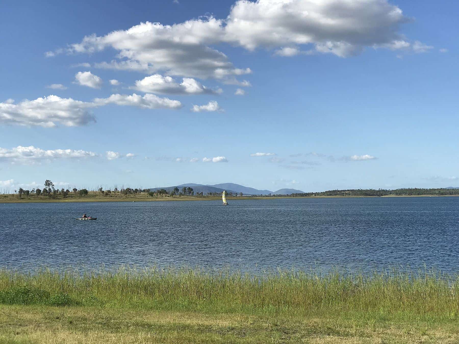
Beyond Maiala, the road continues to two more viewpoints. At Westridge Outlook, a boardwalk circles a rocky outcrop with views across the ranges and over the plains. Wivenhoe Outlook has sweeping views over Lake Wivenhoe and to the west. Neither has toilets. From here the road becomes the Northbrook Parkway, descending to the lake; see our Northbrook Parkway guide.
The forest changes as you climb
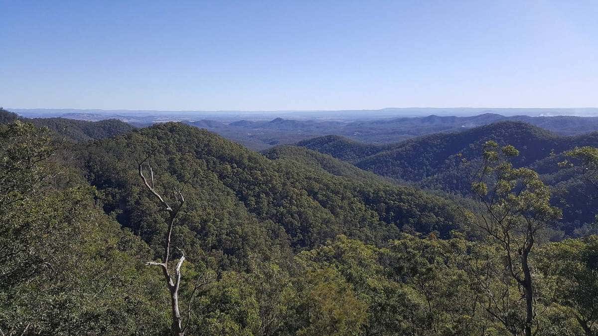
One of the pleasures of this drive is watching the forest change. Near The Gap, the road passes through drier eucalypt forest and woodland on shallower soils, where spotted gum and narrow-leaved ironbark are among the main trees. As you climb and rainfall increases, the forest grows taller, with grey gum, pink bloodwood and brush box above a thick understorey of ferns and vines. By the time you reach Mount Glorious, pockets of moist subtropical rainforest close over the road, with strangler figs emerging through the canopy. Our rainforest plants guide explains why.
Facilities at a glance
| Stop | Toilets | Barbecue | Picnic tables | Lookout |
|---|---|---|---|---|
| Bellbird Grove | Yes | Yes | Yes | No |
| Camp Mountain lookout | No | No | Yes | Yes |
| Jollys Lookout | Yes | Yes | Yes | Yes |
| Boombana | No | No | No | No |
| Manorina | No | No | No | No |
| Maiala | Yes | Yes | Yes | No |
| Westridge Outlook | No | No | No | Yes |
| Wivenhoe Outlook | No | No | No | Yes |
Source: QPWS D'Aguilar National Park attractions listing.
Driving tips
- Take it slowly. The road is narrow in places, with blind corners and steep grades.
- Share the road. Expect cyclists and motorcyclists, especially on weekends. Overtake only where it is safe and legal, and give cyclists plenty of room.
- Use low gears downhill. Let the engine help you brake on the long descents.
- Watch for wildlife. Pademelons and brush-turkeys often cross, especially at dawn and dusk.
- Fog. Mist can descend suddenly on the upper slopes. Use headlights and slow down.
- Pull over safely. Use designated car parks and pull-offs rather than stopping on bends.
See our guide to riding Mount Glorious safely for more on sharing the road.
Suggested itineraries
Half day: Walkabout Creek, Jollys Lookout and the Egernia circuit, then on to Maiala for the Rainforest circuit and a picnic. Return via Samford.
Full day: Morning walk at Bellbird Grove, lunch at Mount Glorious, Greenes Falls in the afternoon, then sunset at Westridge Outlook.
With kids: Walkabout Creek wildlife centre, the short Pitta circuit at Boombana, then the Rainforest circuit at Maiala and a barbecue.
Scenic drive checklist
0 of 6 done
Ticks are saved in this browser only.
Frequently asked questions
Where does Mount Nebo Road start?
Mount Nebo Road begins in the Brisbane suburb of The Gap, near Walkabout Creek Discovery Centre at the southern gateway to D'Aguilar National Park.
How far is Maiala from Walkabout Creek?
QPWS gives the distance from Walkabout Creek Discovery Centre to Maiala as about 30 kilometres along Mount Nebo Road.
What is the best lookout on Mount Nebo Road?
Jollys Lookout is the best known, with sweeping panoramic views, picnic tables, barbecues and toilets. Beyond Mount Glorious, Westridge Outlook and Wivenhoe Outlook offer views to the west.
Are there toilets along the way?
Yes, at Walkabout Creek Discovery Centre, Bellbird Grove, Jollys Lookout and Maiala. Boombana and Manorina have no toilets.
Is Mount Nebo Road steep?
Yes. It is sealed and suitable for conventional vehicles, but it is steep and winding, with many tight bends. Allow plenty of time.
Can I walk at Jollys Lookout?
Yes. The Egernia circuit is a 1.5 kilometre Grade 3 loop allowing about 45 minutes, and the Thylogale track is an 8 kilometre return walk allowing about three hours.
Sources and further reading
Facts on this page were checked against these primary and official sources. Conditions change — confirm before you travel or buy.
- D'Aguilar National Park – Attractions — Queensland Parks and Wildlife Service
- D'Aguilar National Park – Things to do — Queensland Parks and Wildlife Service
- D'Aguilar National Park – About — Queensland Parks and Wildlife Service
- Mount Nebo, Queensland — Wikipedia
- D'Aguilar Range — Wikipedia