The roads up to Mount Glorious draw people on two wheels as much as four. Road cyclists climb from The Gap or Samford for the challenge and the views; motorcyclists come for the bends, and the community association notes that the village attracts motorcyclists who appreciate the scenic drive and cooler climate. Add tourists in cars, locals heading home and the odd pademelon, and you have a road that needs patience and respect. This guide brings together the rules and common-sense tips that help everyone get home safely.
We do not publish crash statistics or rank the roads by danger. Conditions change, and the best source of current advice is the Queensland Government and the relevant road authority. Always ride and drive to the conditions on the day.
1 m
Passing gap
Limit 60 km/h or less
1.5 m
Passing gap
Limit over 60 km/h
0
Fuel stations
On the mountain
The roads
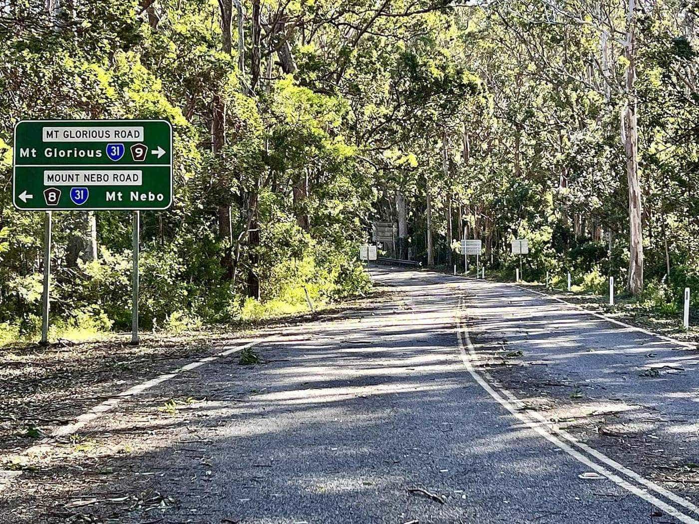
There are three sealed roads on the mountain:
- Mount Nebo Road, tourist route 8, from The Gap through Mount Nebo to Mount Glorious. QPWS gives the distance from Walkabout Creek to Maiala as about 30 kilometres.
- Mount Glorious Road (Samford–Mount Glorious Road), from Samford to the village. QPWS gives about 19 kilometres from Samford to Maiala.
- The Northbrook Parkway, from Mount Glorious down the western side of the range to Lake Wivenhoe.
All three are narrow and winding, with steep grades, blind corners, limited shoulders and changing surfaces. They pass through national park, so wildlife is never far away.
For drivers
Passing cyclists
The Queensland Road Rules set a minimum passing distance for drivers overtaking bicycle riders:
- at least 1 metre where the speed limit is 60 km/h or less, and
- at least 1.5 metres where the speed limit is more than 60 km/h.
Drivers may cross centre lines, including double unbroken lines, to pass a bicycle rider, but only if they have a clear view of oncoming traffic and it is safe. On a mountain road full of blind corners, that often means waiting. A few seconds behind a climbing cyclist costs you very little.
Other tips for drivers
- Expect riders on every bend, especially on weekend mornings.
- Do not cut corners. Keep left, particularly on blind right-hand bends where oncoming motorcyclists or cyclists may be close to the centre line.
- Use low gears on descents to avoid overheating your brakes.
- Pull over to let faster traffic pass using safe, designated pull-offs, rather than stopping on a bend.
- Watch for wildlife at dawn and dusk.
- Use headlights in mist, which can descend suddenly on the upper slopes.
For cyclists
- Be visible. Bright clothing and front and rear lights help in the shade of the forest and in mist.
- Ride predictably. Hold a steady line and signal clearly.
- Know the rules. Queensland rules allow riders to ride two abreast, no more than 1.5 metres apart. On narrow, winding roads, single file is often safer and more courteous where traffic is building behind you.
- Control your descent. Descents are long and technical. Brake before corners, not in them, and watch for gravel, leaf litter and wet patches under the trees.
- Carry supplies. There are no shops on the mountain, and the village cafe may not be open. Take enough water, food, a spare tube, tools and a charged phone.
- Plan for the weather. It is cooler and often damp at the top. A light jacket for the descent is worth carrying even on a warm day.
For motorcyclists
- Ride to the conditions. The roads have tight bends, changing camber and patches of debris, moss or water under the canopy.
- Stay in your lane. Oncoming cyclists, cars and other riders may be just around the corner.
- Watch the surface. Leaf litter, fallen bark and wet patches can linger long after rain in shaded sections.
- Respect the villages. Mount Nebo and Mount Glorious are residential communities. Keep noise down and speeds low through town.
- Look out for walkers crossing near Maiala, Jollys Lookout and other day-use areas.

Mountain biking in the park
Mountain bikes are permitted on all management roads in D'Aguilar National Park unless signed otherwise. QPWS notes that some management roads are not suitable for mountain biking because of very steep gradients and rough terrain, that high fitness and sound navigation skills are needed, and that new riders should carry the South D'Aguilar topographic map, sold at Walkabout Creek Discovery Centre.
There are no designated mountain-bike-only trails in the park, and bikes are not permitted on walking tracks. Riders share management roads with walkers, horse riders and vehicles and must follow the park's give way code. No permit is needed unless the ride is commercial, organised or competitive. For purpose-built trails, QPWS points riders to Bunyaville, Samford and Daisy Hill conservation parks and to parts of Mt Coot-tha Forest.
Weather and conditions
- Mist is common at any time of year, cutting visibility quickly.
- Rain makes shaded corners slippery, and leaf litter can wash onto the road.
- Heat can be intense on the lower climbs in summer, even when the top is cool.
- Storms can bring down branches and trees. Check for closures after severe weather.
Planning your ride
- Check the forecast and alerts before you leave, including QPWS park alerts and road conditions.
- Tell someone your route and expected return time.
- Choose your time. Early mornings bring cooler temperatures but also low sun and busy weekend groups. Weekdays are quieter.
- Fuel up. There is no fuel on the mountain. Motorcyclists and drivers should fill up before the climb.
- Carry ID and an emergency contact.
Ride-day checklist
0 of 6 done
Ticks are saved in this browser only.
A shared road
The roads to Mount Glorious belong to everyone, including the people who live on the mountain. Patience on a blind bend, a wave to a rider who pulls over to let you pass and a gentle throttle through the villages go a long way. Ride and drive as if your family were around the next corner.
Frequently asked questions
Is Mount Glorious a popular cycling climb?
Yes. The sealed climbs up Mount Nebo Road from The Gap and Mount Glorious Road from Samford are well known among Brisbane road cyclists, and the roads are also popular with motorcyclists, especially on weekends.
How much room must drivers give cyclists in Queensland?
Queensland road rules require drivers to leave at least 1 metre when passing a bicycle rider where the speed limit is 60 km/h or less, and at least 1.5 metres where the limit is more than 60 km/h. Drivers may cross centre lines, including double lines, to pass if it is safe.
Can I mountain bike in the national park?
Mountain bikes are permitted on all management roads in D'Aguilar National Park unless otherwise signed, but not on designated walking tracks. Some management roads are very steep and rough, and a topographic map is recommended.
Where can I stop for water on the climb?
The day-use areas at Bellbird Grove, Jollys Lookout and Maiala have toilets. The village has a cafe, but no shops or fuel. Carry enough water and food for the whole ride.
Is there mobile reception?
Reception on the mountain is variable. Ride with a companion if possible and let someone know your plans.
Are there trail-bike tracks?
Not in the southern section of the park. Registered trail bikes and 4WDs can use the forest drives and unsealed roads in the northern Mount Mee section, unless signed otherwise.
Sources and further reading
Facts on this page were checked against these primary and official sources. Conditions change — confirm before you travel or buy.
- Sharing the road with bicycle and personal mobility device riders — Queensland Government
- Queensland Road Rules — Queensland Government
- StreetSmarts – Bicycle riders tools and tips — Queensland Government
- D'Aguilar National Park – Things to do — Queensland Parks and Wildlife Service
- Mount Glorious Community Association — Mount Glorious Community Association